St. Marys River (Florida–Georgia)
 Aerial photo of St. Marys River dividing border of Georgia (left) and Florida (right) from 26,000 feet altitude | |
 St. Marys River watershed | |
| Location | |
|---|---|
| Country | United States |
| State | Florida, Georgia |
| Physical characteristics | |
| Mouth | Atlantic Ocean |
• coordinates | 30°43′23″N 81°29′41″W / 30.72306°N 81.49472°W |
| Length | 236 mi (380 km) |

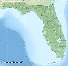
The St. Marys River (named Saint Marys River by the United States Geological Survey,[1]) is a 126-mile-long (203 km)[2] river in the southeastern United States. The river was known to the Timucua[3][4] as Thlathlothlaguphka,[5] or Phlaphlagaphgaw,[6] meaning "rotten fish".[7] French explorer Jean Ribault named the river the Seine when he encountered it in 1562.[8][9] From near its source in the Okefenokee Swamp, to its mouth at the Atlantic Ocean, it forms a portion of the border between the U.S. states of Georgia and Florida. Part or the river runs along the southernmost point in the state of Georgia.
The St. Marys River rises as a tiny stream, River Styx, flowing from the western edge of Trail Ridge, the geological relic of a barrier island/dune system, and into the southeastern Okefenokee Swamp. Arching to the northwest, it loses its channel within the swamp, then turns back to the southwest and reforms a stream, at which point it becomes the St. Marys River. Joined by another stream, Moccasin Creek, the river emerges from the Okefenokee Swamp at Baxter, Florida/Moniac, Georgia. It then flows south, then east, then north, then east-southeast intersecting I-95 near Yulee, and finally emptying its waters into the Atlantic, near St. Marys, Georgia and Fernandina Beach, Florida.
Name
[edit]The U.S. Board on Geographic Names discourages the use of apostrophes in place names, including St. Marys River.[10][11]
1805 incident
[edit]On 6 July 1805, Lieutenant Robert Pigot of HMS Cambrian arrived off the harbour in the French privateer schooner Matilda, which the British had captured three days earlier. On 7 July Pigot took Matilda twelve miles (nineteen kilometres) up the St Marys River to attack three vessels reported to be there. Along the way militia and riflemen fired on Matilda. Eventually the British reached the three vessels, which were lashed in a line across the river. They consisted of a Spanish privateer schooner and her two British prizes, the ship Golden Grove and the brig Ceres, which the Spanish privateer had captured some two months earlier. The Spaniards had armed Golden Grove with eight 6-pounder guns and six swivels, and given her a crew of 50 men. The brig too was armed with swivels and small arms. The Spanish schooner carried six guns and a crew of 70 men.[12]
Pigot engaged the vessels for an hour, and then after Matilda had grounded, took his crew in her boats and captured Golden Grove. The British then captured the other two vessels. Lastly, Pigot fired on a group of 100 militia, with a field gun, dispersing them. The British had two men killed, and 14 wounded, including Pigot, who had received two bullet wounds to head and one to a leg. A crowd of Americans on the Georgia side of the river watched the entire battle.[12]
War of 1812
[edit]Literature
[edit]Martin, Charles. Where the River Ends. New York, Broadway Books, 2008. ISBN 9780767926980. An artist and his dying wife fulfill her wish of one last canoe ride from the headwaters of the St. Marys to the sea.
See also
[edit]- List of rivers of Florida
- List of rivers of Georgia (U.S. state)
- List of rivers of the Americas by coastline
- South Atlantic-Gulf Water Resource Region
References
[edit]- ^ U.S. Geological Survey Geographic Names Information System: Saint Marys River
- ^ U.S. Geological Survey. National Hydrography Dataset high-resolution flowline data. The National Map, accessed April 21, 2011
- ^ "St. Marys". The River Basin Center. University of Georgia. Retrieved 2024-08-03.
- ^ Jennings, Cecil A.; Anderson, Elizabeth P.; Benke, Arthur C.; Kwak, Tom J.; Scott, Mark C.; Smock, Leonard A. (2023-04-20). "Atlantic Coast Rivers of the Southeastern United States". In Delong, Michael D.; Jardine, Timothy D.; Benke, Arthur C.; Cushing, Colbert E. (eds.). Rivers of North America (2nd ed.). London: Academic Press. p. 105. ISBN 978-0-12-818848-4.
- ^ Wright, Albert Hazen (1941). Studies in History. A. H. Wright. p. 3.
- ^ Unknown, reproduced from Crown collection of maps by A.B. Hulbert, v. 5. "Spanish Trail Map of Florida, ca. 1750". Florida Memory. U.S. Government. Retrieved 26 October 2021.
{{cite web}}: CS1 maint: multiple names: authors list (link) CS1 maint: numeric names: authors list (link) - ^ Bartlett, Richard A. (1984). Rolling Rivers: An Encyclopedia of America's Rivers. McGraw-Hill. p. 79. ISBN 978-0-07-003910-0.
- ^ Quinn, David B. (1990). Explorers and Colonies: America, 1500-1625. Hambledon Press. p. 259. ISBN 978-1-85285-024-1.
- ^ King, Spencer Bidwell (2010). Georgia Voices: A Documentary History to 1872. University of Georgia Press. p. 2. ISBN 978-0-8203-3540-7.
- ^ "Obscure Federal Rule Erased Apostrophes from Place Names". Review Journal. 6 February 2018.
- ^ "Names". Wall Street Journal.
- ^ a b "No. 15844". The London Gazette. 17 September 1805. pp. 1181–1182.
External links
[edit]- State of Florida: Guide to the St. Marys River
- St. Marys River Watershed - Florida DEP

